Formidable fortress
Steeped in history, this city lies at the doorstep of Colombo dwellers, with some even living in areas that once had pride of place, with the royal palace being sited there. While the streets of Colombo and its suburbs were a-bustle with vehicles chock-a-block heading for schools and offices on a Monday,
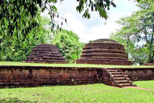
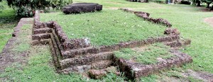
Vehera Kanda ruins which appear to be tombs outside the Kotte fortress. Pix by M.A. Pushpa Kumara
the Sunday Times team accompanied by self-made archaeologist, Prasad Fonseka, was chugging along in a motorboat expertly handled by two navy personnel towards the ancient city of Kotte.
It was from the canal point at the entry to the Open University off the Narahenpita-Nawala Road that we set off to find the clues to the Kingdom of Kotte hidden in properties on which are homes, temples and churches and even Siri Kotha and the Jathika Sevaka Sangamaya (JSS) of the United National Party (UNP).
Expertly guided by navy personnel, we pass both posh and not-so-posh homes on the canal front with cormorants (diyakavo) and other water-birds for company. Some areas flanking the canal are sans habitation but with thick foliage. We also pass a couple of fishermen, out for an early catch. No traffic jams or traffic lights, it is a stress-free voyage into the past.
A history lesson unfolds from the time we step into the boat, from Prasad who is pursuing his love of archaeology by studying for a Master’s degree at the Post-Graduate Institute of Archaeology.
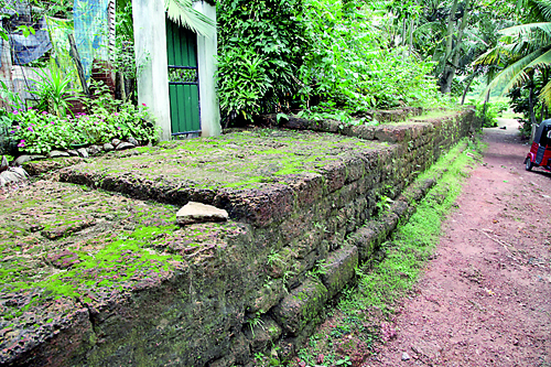
A piece of history in the form of a rampart near the inner-moat
Prasad explains that the Kolon Oya straddles Kotte and the ancient dam had been built at a point just beyond where the two branches met at the northern end of Kotte.
Amazing facts spill forth………for 190 years, the defences of ‘Kotte’, which means ‘fortress’ in Tamil, could not be breached. The city could only be entered through seven ‘passes’ – one over land, another over a drawbridge and the other five through the ancient Diyawanna Lake. The land access, a 200-ft defile was at Pita Kotte, while the Ambalama pass (which had been at Rajagiriya but is now gone forever) had a wooden drawbridge.
“This was called the Ambalama pass because most probably it had an ambalama where people had to linger before being summoned into the fortress,” conjectures Prasad.
The fortifications of Kotte which lie buried in the dim mists of time, may have been first constructed around 1380, it is learnt.
And the secret of Kotte’s defences lay in humble mud.

Scenic boatride to an ancient capital
Nissanka Alakesvara, a powerful minister of Vikramabahu III — who was ruling the Gampola Kingdom — fortified a marshy area, known as Darugama, south of the Kelani Ganga and set up Kotte. Deciding to go against the norm, he chased away the tax collectors of the Jaffna Kingdom, according to Prasad.
Referring to the two stages of ancient Kotte’s development, he points out that earlier Alakesvara built a formidable fortress which included a deep moat, bastions at points of entry into the city and giant granite ramparts. Much later Parakramabahu VI developed the inner city with another moat and “nominal” ramparts of cabook as a secondary defence, as was the tradition, as his palace and the Dalada Maligawa were located within it.
Although impregnable the fortress was, an intricate tunnel system and a ditch had been in place as a secret escape route as well as a launching pad for an attack when besieged, the Sunday Times learns. Later, during the occupation of Kotte by the Portuguese, walls had been built across the passes and cannon fitted.
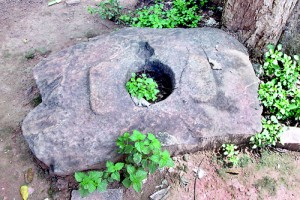
Squatting pan in the premises of the Kotte Raja Maha Viharaya
In hindsight, Prasad who calls Nissanka Alakesvara “one of the greatest war strategists” of ancient Lanka, explains that he built the fortress from scratch, making use of the water and mud surrounding Kotte as a defence. With a uniform and level layer of mud all around, infested with massive crocodiles giving natural protection, he built a bund to allow the water to rise up several feet as well as an amunu gilma to regulate the water-level.
Quoting the Nikaya Sangrahaya of 1396, Prasad explains that the moat around the fortress was deep and deadly, while the ramparts of granite were fortified with iron spikes. There was a mechanism that resembled the mouth of a tiger and tools similar to horns made of iron (“may be like today’s caltrops”). The security posts were sited on wooden pillars while poisonous panels and machines that could kill anyone who got close were all part of the defence strategy.
Originally there were no ramparts and Alakesvara had built them taking the ancient city of Mithila in India as a model, it is learnt.
Prasad says the Nikaya Sangrahaya creates the image of buildings of various levels, one to five-storey high, decorated bastions, watch towers, devala, temples and roads.
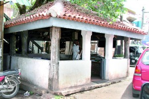
Gal Ambalama outside the fortress, near Siri Kotha
The five passes through the lake were made by removing the mud and he cites Couto as stating that during war-time, they were blocked with debris.
“Even Rajasinha I, considered one of the greatest warriors of this country, was unable to enter the fortress though he launched his armies against it for nearly seven years,” says Prasad, adding that the downfall of Kotte could come in the form of a long siege and the besieged being starved out.
Every year, Rajasinha I’s troops would surround Kotte and camp there for five months and though Nissanka Alakesvara in his time had enough stocks of food against such emergencies posed by enemies, the Portuguese whom Rajasinha I was targeting did not. So they suffered and struggled, it is understood.
This turned out to be the great oversight of the beleaguered Portuguese, who in 1565 ultimately abandoned Kotte, after levelling it to the ground.
| Don’t miss the hotspotsHaving given the history of Kotte in a nutshell, Prasad takes us to the landmarks of yore.
-Where Siri Kotha is located now was the deep moat and the dam across Kolon Oya built by Nissanka Alakesvara. One branch of the Kolon Oya has become part of the Wellawatte canal and the other probably forms the reservoir of the newly-created Diyawanna. -The road the Portuguese used to access Colombo through the Ambalama pass is where the Lion’s Club office is currently located, near the first bridge when going towards Parliament from Rajagiriya. The ancient drawbridge would have been parallel to the present bridge that hundreds of people pass through today oblivious of the history surrounding it. -Of the other five passes, the main Kontagantota pass would have been near the present Parakumba Pirivena, while two more passes east and west (the Angampitiya pass) are close to the Athul Kotte museum. The inner city gate would have been in the premises of the Salvation Army building. The remains of the Angampitiya bastion can be identified and should be conserved, urges Prasad. - The other two passes would have been near Siri Kotha. -A Portuguese ‘vallation’, or wall-like fortification was a large area raised from ground level which could accommodate numerous soldiers. From their vantage point, they would have been able to spot the enemy approaching from afar and attack them. According to Prasad such a vallation would have been present on the premises of the Salvation Army. - The ditch that the Portuguese used to attack Rajasinha I’s troops and the two-tunnel junction are located at the Ananda Shastralaya Vidyalaya. There are plans by the Archaeology Department and the Kotte Municipal Council to carry out excavations here, he says. - The Gal Ambalama at Pita Kotte junction while being a resting place would also have doubled up as an air-inlet for the underground tunnels, believes Prasad. This is the first air-inlet after the two-tunnel junction at Ananda Shasthralaya. There is a third tunnel from the Gal Ambalama and Prasad is bent on finding where it leads to. |


