Kids NEWS
View(s):June 23, 2015
A recent earthquake in Nepal has shifted Mount Everest and nearby mountains.
In April, a devastating earthquake hit the Asian nation of Nepal. New scientific data shows that the quake was so powerful that it moved some of the highest mountains in the world—including Mount Everest, Earth’s tallest peak.

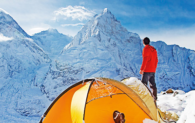
Mount Everest, earth's tallest peak, is part of the Himalaya mountain range in Asia.
When the earthquake struck, it shook mountains in the region, triggering several avalanches. An enormous avalanche on Mount Everest destroyed a camp for climbers about two thirds of the way up the mountain. A number of climbers were killed, and many others were trapped on the mountain’s steep, icy slopes for days before they were airlifted to safety.
Since the earthquake, experts have been studying geographic data of the region. Shortly after the quake, some thought that the famous peak had shrunk by about an inch. Now, new information shows that the mountain has shifted southwest a little more than an inch, but its height remains unchanged at 29,029 feet.
The World’s tallest peak
Mount Everest, part of the Himalaya mountain range, sits on the border between Nepal and China. It is a little less than 100 miles from Nepal’s capital, Kathmandu.
Everest’s towering summit (highest point) has long commanded the attention of both climbers and scientists. In 1953, Edmund Hillary and his guide Tenzing Norgay became the first people to successfully reach the peak. To this day, scaling Everest remains one of the most challenging feats of human endurance.
On Shaky Ground
Mount Everest has actually been “on
the move” for years. Scientists think that the Himalaya mountain range was created when two landmasses collided millions of years ago.
The landmasses, or plates, beneath the Himalayas are still moving. In the past decade, one of the plates, the Indian plate, has been pushing into the Eurasian plate. This has raised the Himalayas slightly higher each year. As a result, Mount Everest has grown by more than an inch during this time period.
The movement of these plates also causes earthquakes. As the Indian plate shoves against the Eurasian plate, tension builds up below Earth’s surface. Every now and then, that energy is released, shaking up huge areas of land. This is what happened during the April earthquake in Nepal. The quake unleashed such an immense amount of energy, it registered 7.8 on the moment magnitude scale, which is a scale used to measure earthquakes.
In a matter of minutes, the powerful quake raised the city of Kathmandu by about 3 feet and lowered mountains surrounding Mount Everest. The mighty mountain itself moved 1.2 inches southwest.
Taking Measure
Geoscientists (scientists who study the Earth) carefully monitor shifts in the planet’s crust, or top layer. This helps them keep track of changes and, if possible, forecast future earthquakes. They use satellites and special sensors to collect data about Earth and its landforms, comparing them on different days to catch even tiny movements.
The latest information, based on data from a Chinese satellite system focused on Mount Everest, will help scientists better understand what goes on beneath the Himalayas. While most people get excited about what happens at Mount Everest’s tip, these experts are keeping an eye out for rumblings below Earth’s surface.
Scholastic news


