New techniques created by Colombo University to monitor sea movements
Strict international standards are followed today in transporting goods and people by air or sea and if not following these rules transporters risk being blacklisted. On the other hand these measures are enforced to safeguard lives.

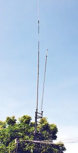
Antenna at Mirissa.
In this context, Sri Lanka is no exception and new measures are constantly being drafted to ensure standards are followed and offenders penalised. For example the Colombo University through its semi-independent arm – Colombo University School of Computing (CUSC) with the assistance of the National Science Foundation (NSF) which has provided partial funding of Rs 2.7 million, has introduced a concept called “Managing Ship Movements via Shore based Station in Udupila, Mirissa, Matara and at the Colombo Port.
The system could identify on a large computer screen anything that moves within a radius of (Very High Frequency (VHF)) of generally 25 to 30 nautical miles, out at sea. The concept is code named ‘Siyara’ and is identified as ‘Three Dimensional (3D) Ship Handling Simulators and Maritime Simulation’ (3DSHSMS).
The kind of concept that is available throughout the world in is two dimension (2D) but the CUSC concept is three dimensional (3D) and is said to be the only one available within the South Asian region.
To gather vital information on this unique creation by CUSC, the NSF along with two of its Scientific Offers accompanied the Business Times (BT) to Mirissa, Coast Guard Headquarters (MCGH) and back to the Colombo University, last week.

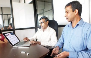
Prof. Nihal Kodikara and Dr. K.D. Sandaruwan
At Mirissa CGH several coastguard officers work in the monitoring and surveillance Control Room. A large monitor visually portrays the entire operations system through which the open sea at the southern tip of Sri Lanka could be seen and monitored. The antenna (sonic sensor) to view and transmit information is erected overlooking the vast sea.
On the southern coast (overlooking the southern tip of Sri Lanka) within 25 nautical miles in the vast open sea is the one of the busiest sea routes in the world where around 100 ships move daily and if not properly guided there could be collisions, causing extensive damages.
At the Colombo University, the BT met the group which had created the unique 3DSHSMS concept. At the helm, Prof. Nihal Kodikara is the Principal Investigator of the concept and the top team includes Prof. Rexi Rosa, Chamath Keppetiyagama, Dr. K.D. Sandaruwan and G.M.A. Dias.
Prof. Kodikara and Dr. Sandaruwan were at the CUSC to appraise the BT. Prof. Kodikara said that the need for the monitoring of ship movements was felt since 1949 with several problems such as noise in the harbour areas; poor classification; lack of sensitivity to small, non-metallic, objects; and merged targets and missed targets. In 2002 the International Maritime Organization (IMO) agreement included a mandate that required most vessels over 300GT on international voyages to have a Class A type AIS (Automatic Identification system) transceiver aand in 2006 the requirement was modified to cover a wide range of applications from the largest vessel to small fishing vessels and life boats.
Dr. Sandaruwan said that in the monitoring of the vessels movement (Broadcast Voyage Information) the system collects information on Maritime Mobile Service Identity; IMO Number; Navigation status; Positional information (Latitude and Longitude); True heading, etc.
Their system, he said is designed to ensure maritime safety and navigation efficiency, protect the harbour and adjacent shore areas from the possible adverse effects of marine traffic and provide important information of the ongoing harbour operations to the top management. The human brain identifies things in three dimension format, he said.
He pointed out that 3D in the system enables a clear identification. It allows faster and complete comprehension; reduces mental overload; enables better decision-making accuracy and a significant reduction in human error when compared with their traditional 2D equivalents.
While the Mirissa operations is about monitoring and guiding, it doesn’t control sea traffic or enforce international maritime laws. It is only to ensure maritime safety. What exactly happens there is to show the way to the east and the west – the correct path – to avoid possible collision. Through this system all the vital information about the vessels moving within the area covered could be obtained automatically, he said.
Dr. Sandaruwan said that through their system nefarious activates like drug trafficking and smuggling could also be detected and checked. He said that they provided these systems to the three armed forces too, with different solutions. He indicated that their new system would certainly have saved a large amount of foreign exchange, for if a similar system is imported and installed the cost could be 10 times higher than their system.


