News
Advanced tools help reduce natural disaster risks
Projects undertaken with the co-operation of geotechnical experts of Norway is helping Sri Lanka to reduce the risk of natural disasters in some parts of the country.

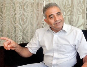
Rajinder Bhasin Pic by Athula Devapriya
The Norwegian Geotechnical Institute (Asia) regional manager, Rajinder Kumar Bhasin, told the Sunday Times the institute is helping in landslide mitigation in Badulla and Matale Districts, and also mapping areas in Matale and Jaffna that are prone to subsidence.
The funding has been provided by The Royal Norwegian Embassy in Colombo since 2012.
The NGI is providing technical assistance to the National Building Research Organization and the Ministry of Disaster Management.
Workshops are being held and NBRO officials are being trained on mitigation of disasters, while field investigations are also undertaken.
Drones have been used to map areas vulnerable to landslides. Software and fast computing machines have been used to gather and process data.
“We extended our project for another two years, after landslides in Aranayake and Meeriyabedda, and the collapse of the Meethotamulla garbage dump,” Bhasin said.
At the Meethotamulla garbage dump site, drones were used to make 3-D models.
Mr Bhasin said seven automatic weather stations were installed to monitor rainfall in areas where landslides occur. Warnings can be given when the rainfall exceeds a certain limit, posing a threat of landslides.
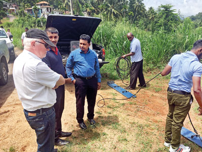
NGI has also provided ground penetrating radar to map subsurface conditions and to detect subsidence. Areas in Matale and Jaffna were mapped.
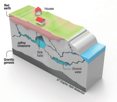
Mr Bhasin said the ground penetrating radar found a number of sinkholes that had been created because the limestone had dissolved.
“When limestone is dissolved by ground water, cavities are created,’’ he said, adding that houses built above such areas could begin to show cracks.
In Jaffna, more investigations are being done before any new infrastructure and buildings are planned.
Remote sensing is also used to identify locations prone to subsidence.
Ground penetrating radar has been used to detect water seepage in the dam of the Nachchaduwa tank.
“Earlier, the area of the water seepage was not detectable but after a survey using GPR, the leakage was detected. Further investigations are being carried out while mitigation efforts are being made,” Mr Bhasin said.
The Norwegian Ambassador, Thorbjorn Gaustadsaether, in a statement in December last year when equipment was donated to Sri Lanka said that Norway supports a policy to tackle the effects of climate change on human settlements. He said that “an effective action-plan of mitigating disaster risks due to the effects of climate change is a priority.’’

Norwegian Ambassador, Thorbjorn Gaustadsaether inspects the equipment

