You can now hop a bus or train and go places with Google Maps

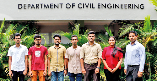
Some members of the team behind the venture with Dr. Dimantha De Silva (far right)
Do you use Google Maps checking the many travel options – driving, riding a motorcycle, walking and taking a taxi before planning a trip? If you have rued the lack of public transit options (bus and rail routes) active in other countries, but unavailable here, rest easy. Last week the transit option was also added thanks to a team from the Civil Engineering Department of the University of Moratuwa in partnership with the National Transport Commission (NTC).
Now, you can check islandwide railway routes and inter-city bus routes starting and ending in the Western Province. Most Western Province bus routes are included and they hope to add the remaining bus routes soon. The time of the entire trip is given, with the walking time also included. Users can also select specialized options that have less walking, fewer transfers etc. through the app.
Led by senior lecturer Dr. Dimantha De Silva and his graduate students assisted by students awaiting university entrance, the team comprised graduate students Sakitha Kumarage, Harini Mendis, Dileepa Fernando, Pubudu Damsara and A/L students Thilakshan Thisaiveerasingam, Lakshan Dissanayake, Tharindu Dissanayake, Mihisara Jayasooriya, Manul Karunasiri, Mayooran Thavendra and Nuwan Prabath.
The idea for the project came when Dr De Silva noticed people using phone applications with incomplete data to find bus routes etc. “Just by giving this information to the general public I knew that we will definitely be attracting more people to public transport,” he explains. It was his Masters student Sakitha Kumarage who suggested that they enter the data into Google Maps (the most widely used app) and so the project began.
When the team contacted Google Maps, they learnt that the company only partnered with local authorities so they approached the NTC. Both, the then Minister of Transport Nimal Siripala de Silva and the current Minister Arjuna Ranatunga were enthusiastic and all the local authorities they contacted were extremely supportive. This included the then chairman of the National Transport Commission M.A.P. Hemachandra as well as current chairman Janaka Mallimarachchi and other NTC officials. Dr De Silva is happy to note that the project cost less than Rs 1 million and was funded by the NTC.
“All we did was take the existing data and put it on the transit feature of Google Maps,” Dr De Silva explains. The team used the data on the websites of the local transport authorities and Jude Vajira Gunasekara shared the data from his app ‘bus routes Colombo’, which had around 50% of the Colombo bus routes. In spite of this, there was data lacking and the only way to get it was by getting on the buses and travelling the entire route, marking all the stops. This was done by the A/L students as well as a few volunteers. Some of the routes had only one bus in the morning and a bus which returned in the evening, so volunteers had to spend the whole day mapping the route.
“One student took a bus without realizing that there was no bus to come back so he had to take a taxi all the way back,” laughs Harini. She and Sakitha were the only two graduate students when the project started, but when Sakitha left to begin his doctoral degree at the University of Queensland, graduate students Dileepa and Pubudu joined mid-project continuing the work. The latitudes and longitudes of each bus stop had to be entered but the hardest thing to do was to make the ‘shape file’, they say. The bends and curves of a route had to be mapped by marking every 100m. “It was really difficult because no one in Sri Lanka has ever done a similar project and even though Google addressed some of our concerns, other suggestions didn’t work in a Sri Lankan context,” explains Harini.
Apart from adding the data of all the other bus routes in Sri Lanka, the team is hopeful they can soon include the real time GPS data of all buses and trains. Now that the data can be available on an app, bus owners etc will see a benefit in installing GPS trackers, making travel even easier to plan through Google Maps, Dr De Silva adds.


