- Last Update 2026-05-14 17:18:00

From Sri Lanka to Uganda - drones set to give global farming a makeover
The traditional image of a farmer standing in a field, squinting anxiously at the sky for signs of rain, may be about to get a 21st-century makeover as researchers explore the use of drones on farms from Sri Lanka to Uganda, the Guardian reported.
The ability of unmanned aerial vehicles (UAVs or drones) to hover low over fields of maize, sweet potato and rice with sensoring devices promises benefits for individual farmers and their communities.
For governments and development agencies, drones can provide more accurate, up-to-date information on what is being grown where. For individual farmers, this kind of information could be the difference between a failed crop and a bumper harvest.
In September, the International Water Management Institute (IWMI) carried outtrials in Sri Lanka using an eBee drone equipped with a near-infrared sensor; the trials showed how this can give farmers early warning of problems anywhere in their fields.
“Using near-infrared, you can identify stress in a plant 10 days before it becomes visible to the eye,” says Salman Siddiqui, head of IWMI’s GIS remote sensing and data unit.
“When a plant goes into stress, it’s either due to a water or fertiliser shortage, or because it’s being attacked by a pest. Photosynthetic activity decreases and that affects the chlorophyll. That’s what the near-infrared sensor can detect, but our human eye can’t see it until it’s more advanced.”
That 10-day warning could prevent large-scale crop losses. Siddiqui says: “If a crop is being attacked by insects, the whole area can be affected, not just one farmer. With UAVs, if you can figure this out before it spreads, you can save the whole area.
In Uganda and Tanzania, theInternational Potato Center (CIP) has been carrying out drone trials in partnership with the national bureaux of statistics in both countries.
Accurate data is crucial for effective agricultural policymaking, and a report(pdf) by the World Bank this year highlighted how patchy that data is for much of sub-Saharan Africa.
According to Dieudonné Harahagazwe, a senior CIP scientist based in Nairobi, this data gap is behind agencies’ eagerness to participate in researching the potential of drones.
“Donors and governments look at statistics, and in some places smallholder plots are so small we don’t have precise statistics on their crops,” he says.
“With sweet potato, for example, policymakers might say it’s not an important crop because there are just small, scattered plots. Or the statistics can’t tell the difference between potato and sweet potato. This is important, because farmers lose out if the statistics are not accurate.”
This was confirmed by CIP’s initial trials using drones to map fields in Uganda. According to its research in the Kumi district of eastern Uganda, official statistics underestimated the planting of sweet potato by a staggering 50%.
Such a disparity between what’s on the books and what’s in the fields can make a crop less visible to policymakers, which means smallholders might not gain access to relevant extension services such as training, seeds or micro-insurance.
This unreliability of data extends beyond crops into livestock, too, and can cause problems in the event of a disease outbreak. The UN’s Food and Agriculture Organisation is researching how drones might be used in these situations, as part of training vets on how to deal with foot and mouth disease (FMD).
“FMD tends to be a problem in the dairy sector, which is important in smallholder settings in countries such as Kenya and Nepal, and there are a whole variety of diseases that affect cattle and other small ruminants,” says Keith Sumption, executive secretary at the FAO’s European commission for the control of FMD.
He says: “There’s often extremely limited data available on the number of animals within a few kilometres, and one of the first questions in disease control operations is how many animals there are within 3km that need to be checked. With a drone in the sky for half an hour, you can probably say exactly where groups of animals are.”
What was wrong with this ad?
Thanks for the feedback! Back
We’ll review this ad to improve your experience in the future.
Help us show you better ads by updating your ads settings.
Thanks for the feedback! Undo
We’ll use your feedback to review ads on this site.
Help us show you better ads by updating your ads settings.
Closing ad: %1$d

-
Still No Comments Posted.


Related Articles
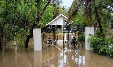
Heavy showers to continue in several provinces, over 30,000 affected
- 14/05/2026 - 43 - 0
Top stories of the day
- 14/05/2026 - 44 - 0
Top stories of the day
- 13/05/2026 - 101 - 0
InPix: Mahinda Rajapaksa leaves Bribery Commission after recording statement
- 13/05/2026 - 30 - 0
Leave Comments