- Last Update 2026-05-12 16:47:00

Cutting edge trends in agriculture and land development using satellite imagery
More than 50% of the land in Sri Lanka is used for agriculture including plantations vital for exports and the domestic economy. But are we making the best use of our valuable land resources? How can we maximise crop output, efficiency and increase income from land? Now - with full satellite coverage of the island and world-class satellite imaging technology available in Sri Lanka (you can analyse objects less than 50 cm long on the ground!) such questions can be rapidly and cost-effectively answered by land owners and public policy makers.
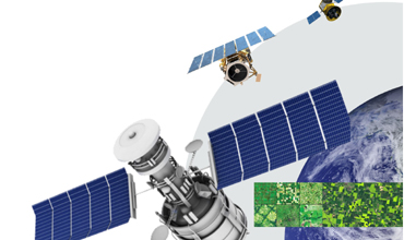
Sri Lanka is in fact behind the curve utilising this technology as many countries such as India have been using satellite images to check the health of crops, predict harvest output, promote effective organic fertilization and manage agricultural land.
How does satellite imagery help in agriculture?
Firstly - Land Use Maps provide a comprehensive and accurate high-detail overview of what you've grown, where you've grown it and to what extent you've developed it. You can take an image of your land using any one of our satellites and generate an accurate land use map within a matter of days because our satellites in space can take images of large areas of hundreds of square kilometres in a single pass. Imagine if you did this manually or used a low-flying drone - it would take so much longer and thereby would be more costly.
For example, plantation owners in Malaysia use satellite images to identify and count trees in both natural and commercial agricultural areas, using powerful software that analyses the image and identifies trees, plants (or whatever you want, including livestock) using artificial intelligence.
So in Sri Lanka wouldn’t it be useful to estimate the number of trees for different types of commercial plantations such as coconut, rubber, teak, palmyra, and even tea, and it will even identify vacant patches in plantations and do health analysis for individual trees or plants (the health of a plant/tree is objectively & accurately measured by analysing the color of the leaf as captured by the digital satellite image).
In fact, satellite imaging allows you to measure many different agricultural parameters such as hydrology, geology, terrain, settlement patterns etc to locate appropriate farmland and enhance the management of your existing agricultural lands. This assists you in making the best decisions to maximise your income from your land.
Today - the use of organic fertilizer to reduce chemical inputs in agriculture is a hot topic in Sri Lanka. Having a macro view of the health of commercial farms with the help of satellite images can help with partitioning areas that can suffice with organic fertilisers and areas where chemical fertilisers are required.
Furthermore - satellite imaging will reduce the cost of fertilization by identifying the exact areas of nutrient deficiency or unhealthy plants. This saves money since it removes the need for fertilization of the entire area. Instead, you can focus just on the chosen hotspots that truly require extra attention through visual characteristics or specialist analysis like NDVI (Normalized Difference Vegetation Index) using satellite images.
In summary satellite imaging now offers more opportunities for today's agricultural industry to develop, extend, and provide smart solutions.
Interested in satellite images? Contact Genesiis Software (Pvt) Ltd., the premier satellite imagery provider since 2001 in Sri Lanka and the Maldives, for all Maxar (USA) and other satellites. Imagery prices start from US$10 per square kilometre with a minimum area of 25 square km. Simply email us your land location and we will reply with an immediate obligation-free quote. Visit www.genesiis.com, www.maxar.com or contact GIS specialist Nishshanka on 0776784883 or nishshanka@genesiis.com.

-
Still No Comments Posted.


Related Articles
Top stories of the day
- 12/05/2026 - 42 - 0
Leave Comments