
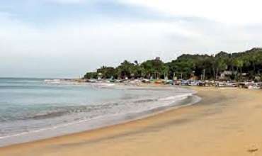
Showers or thundershowers are most likely to occur in certain areas of Eastern, Central and Uva provinces and in Mullaitivu and Polonnaruwa districts notably during the day or night, the Department of Meteorology says.
Extreme downpours will occur more often in Western, Sabaragamuwa and Southern provinces and in Jaffna and Puttalam districts whilst strong winds of about 40-50 KMPH can be anticipated periodically over Western and Southern coastal areas.
A low-level atmospheric disturbance is most likely to loom over the Southeast Bay of Bengal area from tomorrow (May 06) onwards.
A warning has been sent to the naval and fishing communities not to venture into deep shallow sea areas and to take heed of future forecasts sent out by the Department of Meteorology with this in view.
Simultaneously, the Indian Meteorology Department has foretold that Cyclone Mocha is predicted to strike Indian states including Odisha and West Bengal next week, in the wake of the low-level atmospheric disturbance. The cyclone is likely to hit the ground on the nation’s east coast between May 8 and May 11.
Showers or thundershowers will come in bursts at several places in the sea areas around the island. Winds will be south-westerly over the sea area around the island and will strike at 25-35 KMPH. The wind speed may shoot up to 40-50 kmph intermittently in the sea areas off the coast extending from Beruwala to Hambantota via Galle and Matara.
The sea areas off the coast extending from Beruwala to Hambantota via Galle and Matara will be moderately rough at times. The other sea areas around the island will remain slight to moderate.
Temporary strong gusts of wind and very turbulent waters may turn up during thunder showers transiently.


A Thai woman walking topless in Arugam Bay town has been arrested by the Police.

The UK government has unveiled a package of reforms to simplify imports from developing countries which allows for more garments manufactured in Sri Lanka to enter the UK tariff-free.


The Cabinet has approved a proposal for Sri Lankans overseas to apply for their passports through an online system via the Lankan diplomatic missions.
Cabinet has approved the appointment of Commodore (retired) M.B.N.A. Premaratne of the Sri Lanka Navy, as the new Commissioner General of Excise.


Leave Comments