
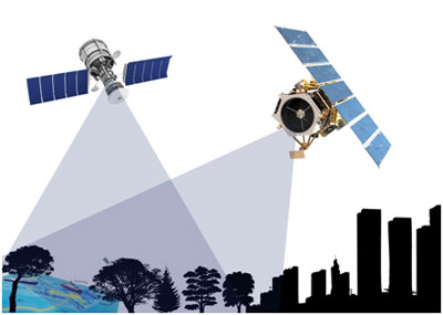
Satellite imagery is utilized for a variety of purposes such as mapping, surveying, defence, and other development initiatives. First and foremost, it is an excellent tool in the academic field, having contributed to the majority of research findings that have benefited our world.
In the Sri Lankan context too, there is a developing trend in the country's academic sector to use this fantastic tool for their research projects.
How can satellite images aid your research?
It lets you see, observe, and analyze objects and features on the land without having to physically visit them. It saves you time since satellite images and image analysis software can do most tasks much faster than traditional methods. Images are now being utilized in more advanced ways in feature extraction and object identification so that you can detect and count objects automatically through AI and machine learning. Besides that, archival satellite images would give you more opportunities to travel back in time and examine how things changed on the land. As a whole, a wealth of information about our changing world can be obtained from different modes of imaging like optical, radar, and short-wave infrared (SWIR) that allows you to delve more deeply into your research problems and acquire the data to validate complex hypotheses.
A trend in state universities
Local universities have shown a significant trend in utilising satellite images in their research projects in recent years.
Since 2014, over 2000 square kilometres of high-resolution optical satellite images from Maxar Technologies (UAS) have been used in various local university research projects. Over the last two years, the amount of satellite images used by the local universities is 1000 square kilometres.
For example, the University of Peradeniya has acquired nearly 400 sq.km of imagery in the last two years for different research projects under the faculty of engineering and faculty of arts. End-uses include bathymetric analysis in some lagoon areas, detection of land-use/land-cover change, extraction of building footprints, and, more recently, identification of a specific tree species in the Horton Plains. High-resolution and very-high-resolution satellite imagery (30cm-50cm) acquired through Maxar (USA) was delivered for the above requirements with utmost satisfaction.
The University of Subaragamuwa in 2020 acquired 50cm and 1m resolution optical satellite images for an area of 590 Sq.km under the AHEAD programme to conduct their studies over selected two districts. The University of Jaffna, the University of Moratuwa, and the University of Sri Jayawardenepura are among the other local universities that have successfully obtained maxar high-resolution satellite imagery for multiple research projects throughout past years.
Interested in satellite images for your research? Contact Genesiis Software (Pvt) Ltd., the premier satellite imaging supplier in Sri Lanka and the Maldives since 2001, for all Maxar (USA) and other satellites, with full island coverage and archival images dating back to 2002. For any academic purpose, attractivediscounts of up to 25% are available. Visit www.genesiis.com, www.maxar.com, or contact Nishshanka, GIS specialist, at 0776784883 or nishshanka@genesiis.com.


A Thai woman walking topless in Arugam Bay town has been arrested by the Police.

The UK government has unveiled a package of reforms to simplify imports from developing countries which allows for more garments manufactured in Sri Lanka to enter the UK tariff-free.
The Cabinet has approved a proposal for Sri Lankans overseas to apply for their passports through an online system via the Lankan diplomatic missions.


Leave Comments